Land Surveying, Civil Engineering, & 3D Reality Capture,
PO Box 360
New Hope, PA 18938
info@crewssurveying.com
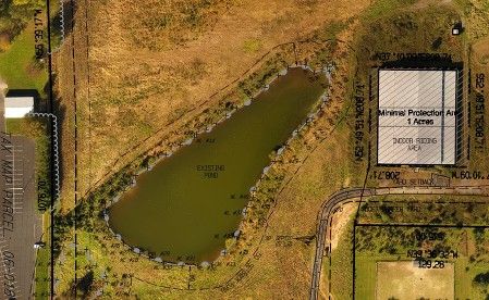
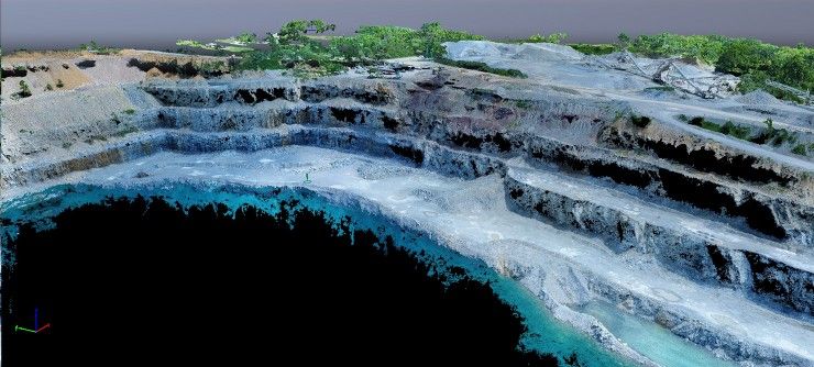
Aerial Mapping with sUAS/Drone
Aerial Mapping by sUAS/Drone
Crews Surveying continues its committment to providing the most efficient services and the most cost-effective solutions. As soon as the FAA authorized Chapter 107 pilot licensure for commerical drone activites Crews Surveying pursued licensure of two employees, obtained multiple drones, and research and training on the specialized software requried for custom processing of ground-controlled UAS mapping. Testing results were outstanding and Crews Surveying has since implemented UAS mapping on a large number of projects as a supplement, or primary means of surveying and mapping the land.